Boston Coal & Fuel Company
Perins Peak
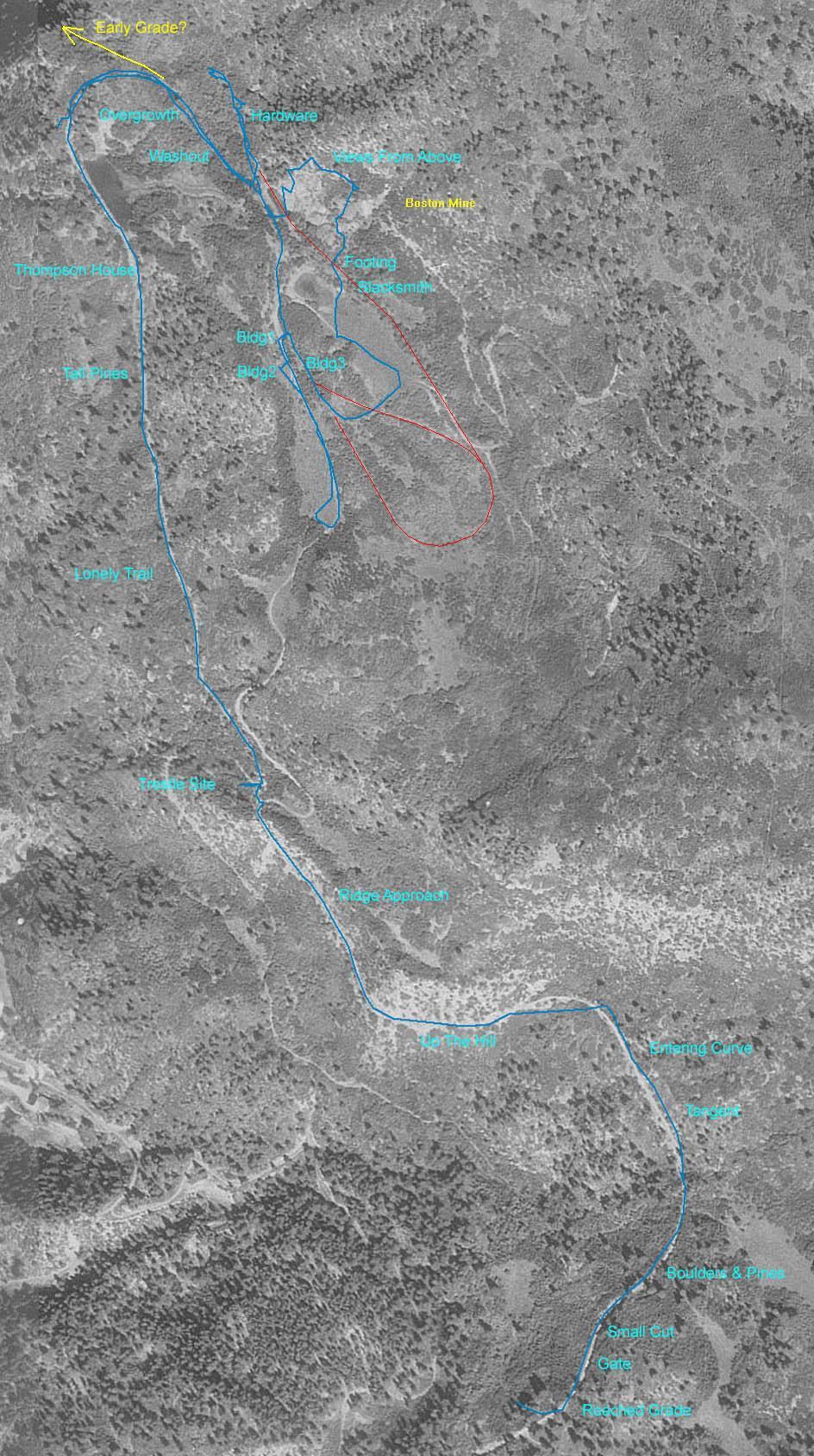
The map below provides an overview of
a hike that I made along the BC&F grade during August of
2006. Click on any of the blue
text to view shots from along the grade. My GPS track from
the hike is plotted in blue and overlays the grade on much of the trip. The
red line is my attempt to highlight parts of the grade that I didn't
hike. The yellow line might possibly be an earlier grade that went
further north but needs to be investigated.
I started my hike from the Lightner Creek
road that is due west of the Tall Pines label on the map. At
the sharp westward bend in the road is a dirt parking area that
is on state land. Signs in the area indicate that the state
land is off limits until mid July to protect the mating Falcons.
I attempted to head due east up the hill from the parking area but
the route is steep and overgrown. I ended up heading southeast for
quite a ways and met the grade just north of Twin Buttes. This ended
up working pretty well as I got to hike a lot more of the grade. This
is probably about the same point you would approach the grade if starting
from the apartment buildings further south on the Lightner Creek road.
On the way out I took a more direct route
via the drainage just north of the Thompson House label. I
can't say that I would recommend this route as it was very steep.
It was the quick way down but it was quite challenging. Be
prepared for bushwhacking and loose footing! I would suggest trying
to follow the ridge line just south of this drainage.
A good source of background material for this
line may be found in "The RGS Story" Volume XI. On page 333 you
will find a map that outlines all of the building that once stood
up near the mine. I found four of the stone structures while wandering
around the company town site.
I have added a topo map here which shows my hike along with notes on
routes that one might take. Topo map
Copyright Dave Dye 2006.
HOME
PAGE